
- India,
- 20-Nov-2026 08:44 AM IST



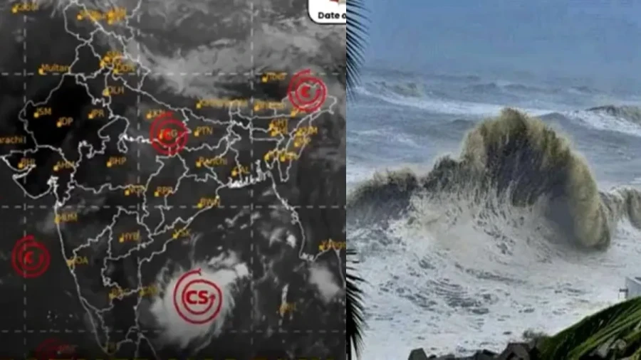
The severe cyclonic storm named Akvan, which formed over the west-central Bay of Bengal, is moving rapidly in a northward direction and is projected to make landfall along the coasts of northern Andhra Pradesh and southern Odisha by the afternoon of November 20. According to the India Meteorological Department, the intensity of the storm at the time of crossing the coast is expected to feature wind speeds ranging between ninety and one hundred kilometers per hour. The far-reaching impact of Cyclone Akvan won't remain confined solely to Odisha and Andhra Pradesh, but will also extend extensively across West Bengal, Jharkhand, Bihar, Chhattisgarh, Madhya Pradesh, and several states in the northeastern region, prompting administrative machinery to declare a high alert.
In view of the impending threat posed by the cyclone, large-scale rescue and relief operations are currently underway on a war footing across the vulnerable states. Specifically in Odisha, which faces the highest level of threat, the local administration has successfully evacuated nearly three hundred thousand people to safe locations as part of extensive precautionary measures. Simultaneously, in order to prioritize passenger safety, the Indian Railways has cancelled a total of forty-five trains as a precautionary step, while rescheduling the timing of twenty-eight other prominent trains. The meteorological department has issued strict advisories warning fishermen against venturing into rough sea waters, while Plus, schools and various educational institutions have been temporarily ordered to remain shut across several sensitive states.
The most devastating impact of Cyclone Akvan is anticipated to be witnessed across the coastal and southern districts of Odisha. According to official data shared by Special Relief Commissioner Rajesh P Patil, a total of two hundred ninety-eight thousand six hundred seventy-six people had already been shifted to secure locations by Thursday evening, while these evacuated citizens have been safely accommodated across two thousand five hundred twenty-three relief camps, where adequate arrangements for food and essential amenities have been meticulously organized. In addition to this, the state government has kept a staggering nine thousand three hundred forty-one shelter homes fully prepared to accommodate citizens should the need for further evacuation arise.
Among all administrative zones, Ganjam district is regarded as the most sensitive and vulnerable area, where one hundred thirty-eight thousand three hundred eleven individuals have been successfully relocated to safer locations. The district administration has proactively utilized public announcement systems to continuously apprise local residents regarding the imminent dangers of the cyclone. Essential facilities including adequate food supplies and medical provisions have been fully arranged within all designated relief camps. Teams comprising the National Disaster Response Force, the Odisha Disaster Rapid Action Force, and the fire services department have been heavily deployed across Ganjam and other sensitive districts. Rescue teams have been stationed across eleven districts of the state, while pregnant women and other vulnerable segments of the population were proactively evacuated to safe zones well in advance.
The meteorological department has issued a red alert warning for heavy to extremely heavy rainfall across Puri, Ganjam, Gajapati, Kandhamal, Kendrapara, and Jagatsinghpur districts, while due to abnormally high tidal waves surge anticipated in the sea, low-lying coastal areas within Ganjam and Puri are projected to experience inundation ranging from half a meter to one meter of water accumulation, prompting authorities to evacuate low-lying zones completely. The ominous impact of the cyclone has already begun manifesting visibly in neighboring West Bengal, where overnight rainfall lashed Kolkata and multiple districts across southern Bengal. Persistent rainfall activity was duly recorded across the coastal belts of South 24 Parganas, East Medinipur, Kolkata, Howrah, and West Medinipur.
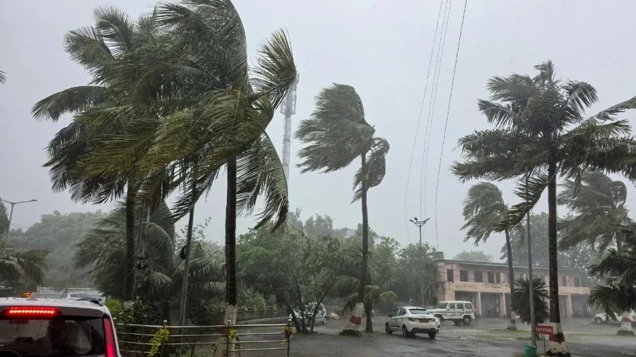
The Met department has further forecasted heavy rainfall across North 24 Parganas, West Medinipur, Jhargram, and Bankura districts. Continuous downpours caused significant disruptions to vehicular traffic across major urban hubs including Kolkata, Salt Lake, and New Town, resulting in severe traffic congestion during the peak morning commuting hours. According to weather forecasts, thunderstorm activities accompanied by gusty winds reaching speeds of thirty to forty kilometers per hour are expected to persist across Kolkata and other southern Bengal districts through Saturday. Authorities have strongly advised fishermen to refrain from entering the sea until November 21.
The looming impact of Cyclone Akvan will also be distinctly experienced across the state of Jharkhand, where the meteorological department has predicted the onset of rainfall starting from November 20 across the southern and central parts of the state. A yellow alert for heavy rainfall has been officially issued for eleven districts on Friday. These designated districts include Lohardaga, Gumla, Simdega, Ramgarh, Ranchi, Khunti, Bokaro, Dhanbad, Seraikela-Kharsawan, West Singhbhum, and East Singhbhum. What's more, heavy rainfall is predicted to lash Giridih, Dhanbad, Deoghar, Jamtara, Dumka, Godda, Pakur, and Sahibganj districts on November 21 and November 22.
In connection with the notable weather shifts expected across Jharkhand, the meteorological department has noted that maximum temperatures may experience a noticeable decline of up to three degrees Celsius over the next three days, whereas minimum temperatures are anticipated to rise by up to four degrees Celsius. The intensity of rainfall is projected to diminish gradually starting from November 23. Central India is also bracing for significant weather modifications driven by the cyclonic disturbance. Widespread rainfall activity is highly likely across Chhattisgarh on November 20 and November 21, accompanied by heavy downpours at isolated locations alongside powerful surface winds gusting between forty and fifty kilometers per hour, with peak wind gusts potentially touching sixty kilometers per hour.
Eastern Madhya Pradesh is expected to witness rainfall and gusty winds between November 20 and November 22, while western Madhya Pradesh may experience precipitation on November 21 and November 22. Scattered to widespread rainfall is also anticipated over Vidarbha on November 20 and November 21. The repercussions of Cyclone Akvan will extend toward Bihar and the northeastern states of the country as well. Bihar is poised to receive rainfall activity between November 21 and November 22, with heavy spells likely to occur over select areas of southeastern Bihar on November 21.
Across the northeastern states of Arunachal Pradesh, Assam, and Meghalaya, rainfall is anticipated from November 20 through November 25, while Nagaland, Manipur, Mizoram, and Tripura could witness precipitation between November 21 and November 25. Specifically, Assam and Meghalaya have been placed on alert for isolated very heavy rainfall events on November 21. While the eastern and southern sectors of the nation grapple with cyclonic storms and heavy downpours, northern India is preparing for foggy conditions. The meteorological department has issued warnings regarding dense fog engulfing Haryana, Chandigarh, Delhi, and Punjab between November 20 and November 22, with strong probabilities of very dense fog affecting western Uttar Pradesh, while eastern Uttar Pradesh may experience foggy weather on November 20 and between November 22 and November 23.