- India,
- 17-May-2021 09:05 PM IST
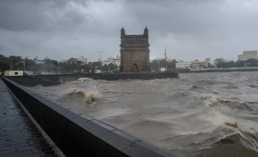
New Delhi / Mumbai: Cyclone Tauktae wreaked havoc in Mumbai with a strong thunderstorm at a speed of 75-85 kmph, which damaged many trees and damaged some homes. The storm disrupted traffic on the road. In another development, the Indian Navy has sent two ships to rescue about 273 ONGC personnel, who are stranded on a drifting boat near Bombay High Fields, about 175 km from Mumbai.
Two dead
There have been reports of at least two deaths from Cyclone Tauktae. A young man died in Navi Mumbai and another woman in Raigad, but authorities are yet to confirm it. An official said the meteorological department upgraded the warnings of 'extremely heavy rains' for Mumbai and strong winds rising to 120 kmph. The effect of a very 'severe cyclonic storm' was felt from Sunday-Monday night, with heavy rain in many areas. At some places accompanied by lightning and thunder, strong winds followed, which had turned north from Sindhudurg and Ratnagiri would enter Raigad-Mumbai via the Gujarat coast.
Many flights canceled, divert
As a major precautionary measure, state officials have already rescued 12,420 people from sensitive places on the banks of Sindhudurg, Ratnagiri and Raigad, an official said, as a major precautionary measure. Chief Minister Uddhav Thackeray is keeping a close watch on the situation. Mumbai's Chhatrapati Shivaji Maharaj International Airport, which was closed for all operations from 11 am to 2 pm, extended the shutdown to 4 pm and later closed until 10 pm. Due to bad weather, even flights from 3 private airlines were diverted.
Waterlogging in many areas
At least 30 big and small trees were uprooted on roads in many parts of Mumbai and Thane at night, apart from minor damage to many houses, major subway floods in Malad, Kandivali, Dahisar, Andheri and Santacruz caused traffic stops While many low-lying areas were waterlogged. In Dahisar, the roof of the huts was damaged a lot. The site for shooting many Bollywood films, signals, electric poles, hoardings in various parts of the city, banners are all uprooted.
Tau-te will reach Gujarat by evening
The India Meteorological Department (IMD) has warned that Cyclone Tau-Te will take an extreme shape in the eastern Central Arabian Sea by Monday night. It is expected to reach 210 kmph at a speed of 180 to 190 kmph. The agency has warned of up to 3 meters of tidal waves on the banks of Amreli, Gir Somnath, Diu and Bhavnagar in Gujarat.
Strong wind blowing in these areas
The meteorological department said thunderstorm wind speeds running at 90 to 100 km per hour at 110 km per hour are adjacent to the northeastern Arabian Sea. It will gradually increase to a speed of 170 to 180 kmph for the subsequent 12 hours to 200 kmph and then decrease thereafter. Right now, thunderstorms are moving along South Gujarat and Daman and Diu coasts at a speed of 70 to 80 kmph and at a speed of 90 kmph. By Tuesday morning, the condition of the sea in the east central and adjacent northeast Arabian Sea will be unprecedented and thereafter there will be a gradual improvement.
