
- India,
- 29-Aug-2026 07:05 PM IST



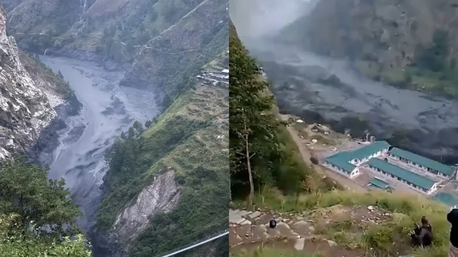
A chilling video has emerged capturing the exact moment a massive glacier collapsed in the high-altitude regions of the Nepal-China border, an event that triggered a catastrophic mudslide and led to widespread devastation. The disaster, which occurred on August 26, has resulted in a staggering death toll, with at least 669 people confirmed dead so far. As search and rescue operations continue in the challenging terrain, authorities report that more than 2000 people remain missing, leaving families in a state of desperate wait and the region in a state of mourning. The footage, which has now become a central piece of evidence for scientists and disaster management officials, provides a rare and terrifying look at the raw power of nature in the Himalayas.
The Moment of Collapse Captured on Camera
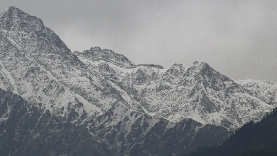
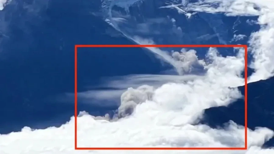
The footage was accidentally recorded by a tourist who was filming the scenic mountain landscapes in Gyirong County, located within the Xizang Autonomous Region of China, while while the tourist was capturing the natural beauty of the peaks, the camera lens caught the terrifying sight of a high-altitude glacier giving way. This specific collapse is now being identified by experts as the primary trigger for the massive mudslide that struck the Gyirong Port area, a vital point on the border between Nepal and China. Specialists who are currently analyzing the footage believe that this video provides crucial evidence regarding the initial stages of the disaster that unfolded on August 26. The visual data is helping researchers understand how such a massive volume of ice and rock could transition into a deadly debris flow so rapidly.
Expert Analysis and Confirmation
Kang Shichang, the Director of the Institute of Mountain Hazards and Environment under the Chinese Academy of Sciences, has provided professional insight into the video. According to Shichang, the location shown in the tourist's footage matches exactly with the site identified through remote-sensing imagery as the source of the disaster. Reports from the Xinhua news agency indicate that the footage depicts the collapse of a glacier on the Nepalese side of the border. This collapse initiated a chain reaction of geological events that culminated in the devastating mudslide at Gyirong Port. The expert analysis confirms that the sheer scale of the ice fall was enough to displace millions of tons of earth and rock, creating a slurry that moved with unstoppable force down the mountain valleys.
The Path of Destruction from Nepal to China
The disaster began in the high-altitude reaches of Nepal, where a massive section of ice and rock broke away from the main glacier body. This collapse sent an enormous volume of debris cascading down the steep mountain slopes. As the mixture of ice, rocks, and mud moved downward, it gained momentum and volume, transforming into a powerful debris flow, while this flow didn't stop at the border; instead, it surged toward China, specifically targeting the Gyirong Port area in Xizang. The path taken by the mudslide followed the natural contours of the mountain valleys, which acted as funnels, further increasing the speed and destructive potential of the moving mass.
Technical Scale of the Catastrophe
According to reports from Chinese media, the glacier segment collapsed at an extreme altitude of approximately 5140 meters. The area affected by the initial collapse was vast, covering nearly 620000 square meters. Once the debris began its descent, it traveled a total distance of about 20 kilometers. One of the most shocking aspects of the event was the rapid loss of elevation; the debris flow dropped nearly 3300 meters in height before it slammed into Gyirong Port. The entire journey from the point of collapse to the port took only about 7 minutes, leaving almost no time for early warning systems or local residents to react. The speed of the flow meant that anyone in its path was caught completely off guard by the wall of mud and rock.
Impact on Infrastructure and Ongoing Relief Efforts
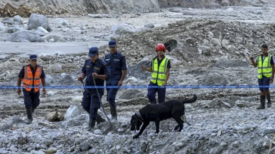
The scale and velocity of the debris flow caused unprecedented damage to the infrastructure on both sides of the Nepal-China border. Entire villages were buried or swept away, while critical roads and bridges that connect the two nations were destroyed. The loss of these transport links has Notably hampered rescue and relief efforts, as heavy machinery and medical supplies struggle to reach the affected zones. Rescue teams are working tirelessly in the difficult mountainous terrain to locate the 2000 missing individuals, though the chances of finding survivors diminish as time passes. Authorities remain on high alert, as the geological stability of the remaining glacier parts is still in question, and there are ongoing concerns about the possibility of further flooding or secondary landslides in the region.
A tourist filming the scenery in Gyirong County, China's Xizang Autonomous Region, accidentally captured the moment of a high-altitude glacier collapse in Nepal.
— China Xinhua News (@XHNews) August 29, 2026
Kang Shichang, director of the Institute of Mountain Hazards and Environment under the Chinese Academy of Sciences,… pic.twitter.com/Sc3lIbjKWo