- India,
- 24-Jan-2026 08:29 AM IST
The weather patterns across North India are set for a significant shift as the India Meteorological Department (IMD) predicts a new wave of cold and precipitation starting January 24, while a combination of a Western Disturbance and a low-pressure area is expected to influence the plains, bringing chilly winds and potential rainfall to several states including Delhi, Uttar Pradesh, Bihar, and Rajasthan.
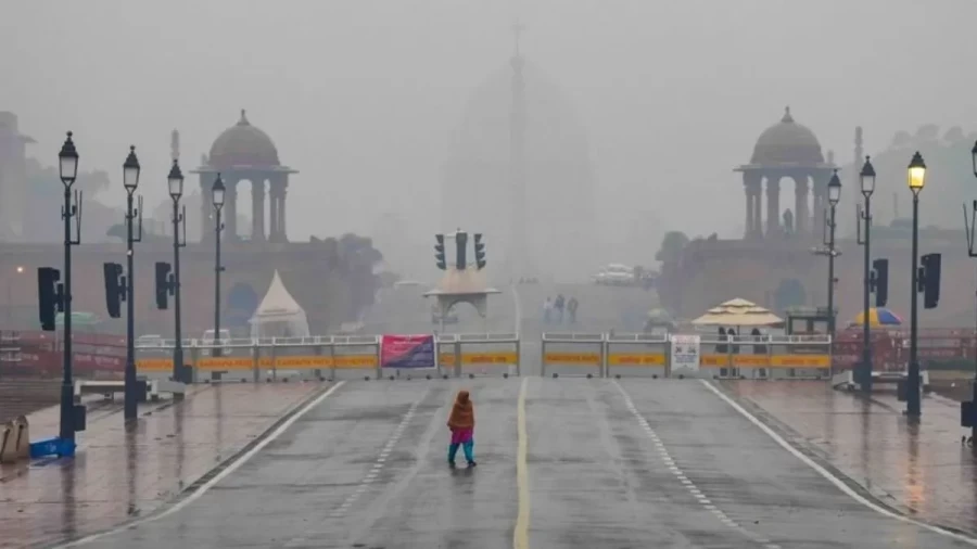
Delhi Weather: Clouds and Chilly Winds
In the national capital, residents should prepare for a cloudy sky and a noticeable dip in temperature. The IMD has forecasted that Delhi will experience minimum temperatures around 7 degrees Celsius. Morning fog might reduce visibility, and surface winds ranging from 10 to 20 kmph will add to the chill factor. While heavy rain isn't expected today, the overcast conditions will keep the maximum temperature lower than usual.
Rain Forecast for Lucknow and Patna
Lucknow is likely to witness light rain or thundershowers today, which could lead to a drop in the mercury to about 10 degrees Celsius. The damp conditions are expected to increase the feeling of cold throughout the day, while in contrast, Patna in Bihar might see clearer skies today with a minimum temperature of 13 degrees Celsius. However, meteorologists suggest that the impact of the Western Disturbance will reach Bihar in the coming 48 hours, potentially bringing clouds and light drizzles.
Rajasthan Braces for Freezing Temperatures
Jaipur and other parts of Rajasthan are under a cold wave alert. The minimum temperature in Jaipur is expected to hover around 5 degrees Celsius. The state is likely to see cloudy skies, and the northern districts might experience ground frost, which could impact seasonal crops. The cold winds blowing from the Himalayan region are the primary reason for this sudden drop in temperature across the desert state.
Impact of Western Disturbance and Snowfall
The Western Himalayan region is currently experiencing the effects of a fresh Western Disturbance. This system is bringing moderate to heavy snowfall in the higher reaches of Jammu and Kashmir, Ladakh, Himachal Pradesh, and Uttarakhand. As these systems move eastward, they pull in cold air from the poles, which then sweeps across the Indo-Gangetic plains, causing what is commonly known as a 'cold wave' or 'cold day' conditions.
Temperature Trends for the Next 48 Hours
According to the IMD, the plains of Northwest India will see a temperature drop of 3 to 5 degrees Celsius over the next 24 hours, while this will be followed by a brief period of stability before another intense Western Disturbance hits between January 26 and 28. This upcoming system is expected to be more potent, potentially causing widespread rain across. Punjab, Haryana, and Western UP, and heavy snow in the mountains on January 27.
Central India and Maharashtra Outlook
Central India is also not immune to these changes. States like Madhya Pradesh and Chhattisgarh might see a gradual fall in minimum temperatures by 2 to 4 degrees Celsius over the next three days, while similarly, Maharashtra is expected to witness a slight dip of 2 to 3 degrees in the next 24 hours. While the southern peninsula remains largely unaffected, the northern and central. Belts are advised to stay prepared for a prolonged winter spell.
