- India,
- 28-Sep-2021 02:19 PM IST
New Delhi: Cyclone Gulab, which made its landfall in Andhra Pradesh on Monday, may weaken further into a deep depression on Tuesday but intensify into a new cyclone later in the week, officials in India Meteorological Department (IMD) familiar with the developments said.
The cyclonic storm is expected to turn into a well-marked low pressure area on Tuesday and emerge in the northeast Arabian sea and Gujarat coast around Thursday. The system may probably intensify on Friday, leading to the development of cyclone Shaheen in the region, the officials cited above said.
“Though chances are less, we cannot rule out the possibility of its intensification into a cyclone. The low-pressure area (remnant of Gulab) will move westwards across central India, bringing a lot of rain in the region. It will cross Maharashtra and Gujarat as a low-pressure system. With an incursion of moisture from the Arabian Sea, the system will be reinvigorated. Rapid intensification of the low-pressure system cannot be ruled out now because the ocean and atmospheric conditions are favourable. The cyclone or depression will move towards northern parts of the Arabian Sea,” Sunitha Devi, in charge of cyclones at IMD, explained.
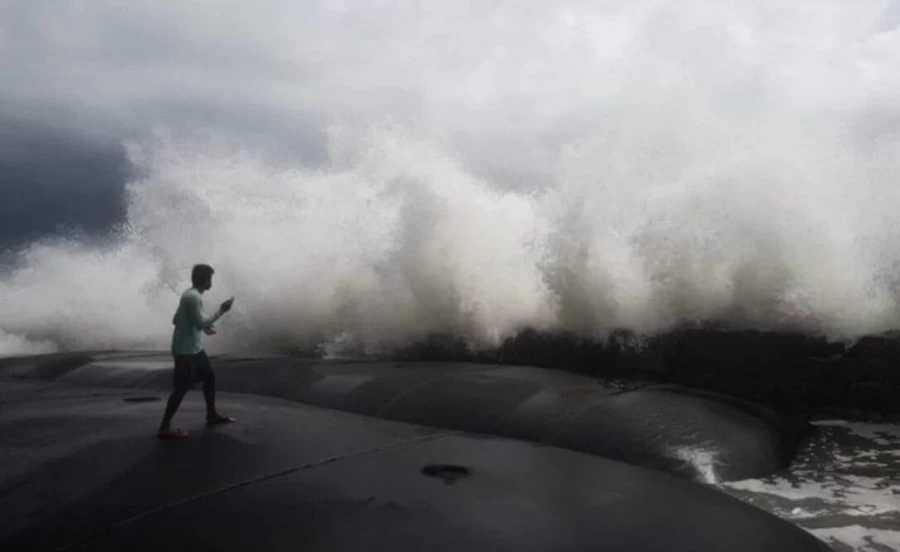
In association with the system, winds are likely to strengthen along the western coast in the next two to three days. The monsoon trough is currently lying to the south of its normal position and is likely to remain there for the next four to five days, the weather body said.
According to Devi, an east-west trough is also running from north Konkan to a cyclonic circulation associated with the deep depression over south Odisha. It is likely to persist for the next two days. A remnant from a cyclone over the Pacific has also emerged as a cyclonic circulation over east central Bay of Bengal. “These consecutive systems will bring widespread rain over different parts of the country for a week,” she said.
Under the influence of these systems, very heavy rainfall to extremely heavy rain (over 20 cm) is very likely at isolated areas over north coastal Andhra Pradesh, south Chhattisgarh, Vidarbha, Kerala and Telangana. Heavy to very heavy rainfall is also expected at isolated regions over south Odisha, central Maharashtra, Konkan, Gujarat, north interior Karnataka and Tamil Nadu for the next two days.
Sea conditions, the IMD said, will be rough to very rough over west central and adjoining northwest Bay of Bengal, and along and off Andhra Pradesh and adjoining Odisha coasts on Monday night.
As on Monday, there has been a 2% deficiency in monsoon rain over the country since June 1. There has been 10% excess rain over south Peninsula, 1% excess over central India, 4% deficiency over northwest India and 24% deficiency over east and northeast India.
Patchy to scattered rain is also likely over several parts of northwest India, including Delhi-NCR, due to movement of the remnant of Gulab in a westerly direction. “We are only expecting scattered rain here. However there will be rain in many other parts of the country due to formation of low pressure systems one after the other mainly due to remnants coming from the Pacific. The monsoon season will officially end on September 30 but its withdrawal may be delayed,” K Sathi Devi, head of national weather forecasting centre, said.
