
- India,
- 07-Sep-2026 05:26 PM IST



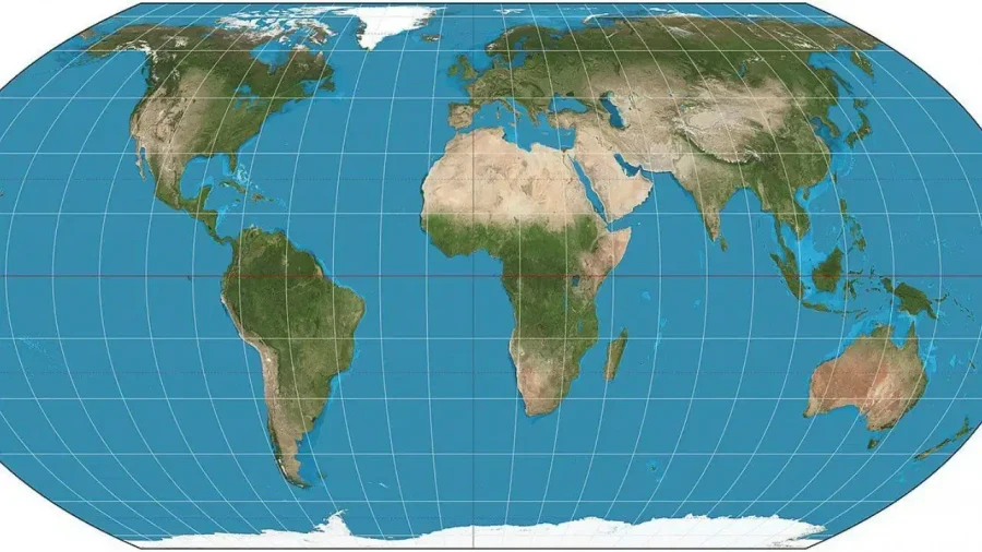
On September 4, the United Nations General Assembly approved a resolution promoting the Equal Earth Map projection with an overwhelming majority of 164-1. While the resolution received widespread support, six countries chose to abstain from the voting process, and the United States of America stood as the lone dissenter, opposing the proposal. It's important to note that this resolution is non-binding in nature and doesn't prohibit the continued use of the traditional Mercator map, while the primary objective of this new map is to represent the surface area of countries and continents in a more accurate proportion, rather than altering political boundaries or territorial claims. Basically, the map changes the visual representation of size without modifying actual land areas or international borders. Consequently, this technical shift doesn't have a direct legal impact on the long-standing Jammu and Kashmir dispute. However, the manner in which Jammu and Kashmir is depicted on this new map has triggered a fresh wave of diplomatic tension and rhetoric between India and Pakistan.
India's Firm Stance on Sovereignty
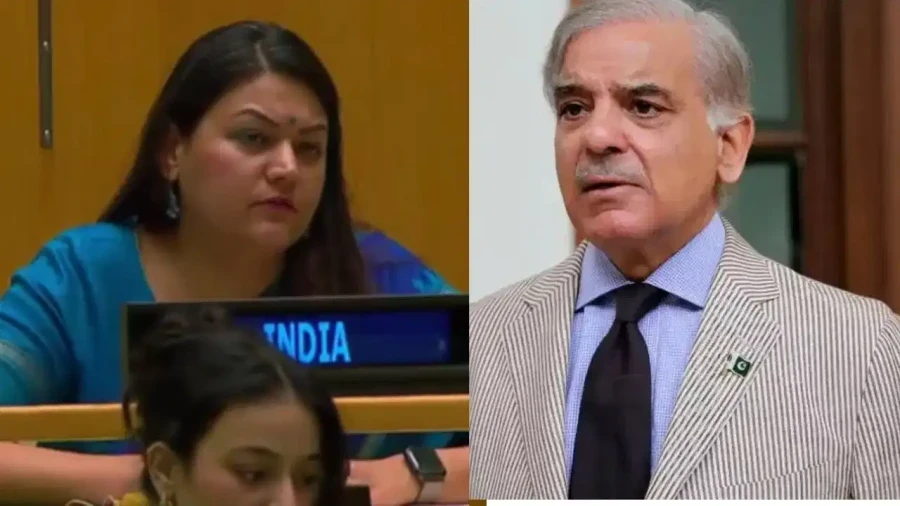
India supported the UN resolution but maintained a cautious and technically neutral stance, while the Indian government emphasized that the adoption of the Equal Earth Map shouldn't be interpreted as an endorsement of any single map projection over others. India argued that different maps serve different purposes; while some prioritize accurate area representation, others are designed to maintain correct directions, angles, or distances. Randhir Jaiswal, the spokesperson for the Ministry of External Affairs, clarified India's position by stating that India's sovereign territory, which includes the Union Territories of Jammu and Kashmir and Ladakh, must be depicted in any map according to India's official geographical records. India has categorically stated that any incorrect or misleading depiction of its territory is entirely unacceptable and must be rectified to align with its official maps.
Pakistan's Objections and the Disputed Narrative
Pakistan has reacted to the new map by reiterating its traditional stance on Jammu and Kashmir, labeling it a disputed territory. The Pakistani administration argued that the final status of Kashmir must be decided in accordance with the relevant United Nations Security Council resolutions and the aspirations of the Kashmiri people. Pakistan has a long history of rejecting India's official maps and continues to claim that India's internal mapping of Jammu and Kashmir as its integral part doesn't nullify the international status of the region as a disputed zone. This diplomatic friction highlights that the controversy surrounding the Equal Earth Map is less about its mathematical projection and more about the political sensitivities of regional borders.
The United Nations Clarification on Boundaries
The United Nations has provided a detailed clarification to address the concerns raised by various member states. The UN emphasized that the Equal Earth Map doesn't signify a change in the political status of Jammu and Kashmir. The world body outlined four critical points regarding the new map, while first, the boundaries, names of countries, and symbols used on the map don't imply official recognition or endorsement by the United Nations. Second, it noted that the final boundary between Sudan and South Sudan has not yet been determined. Third, regarding Jammu and Kashmir, the UN stated that the Line of Control (LoC) agreed upon by India and Pakistan is represented by a dotted line, indicating that a final agreement on the status of the region has not been reached. Fourth, the map acknowledges the ongoing sovereignty dispute between Argentina and the United Kingdom over the Falkland Islands (Malvinas).
Mercator vs. Equal Earth: The Science of Projection
To understand the shift to the Equal Earth Map, one must look at the history of the Mercator projection. Created by Gerardus Mercator in 1569, this map was designed specifically for maritime navigation. Its primary advantage is that a ship sailing in a constant direction appears as a straight line on the map, making it indispensable for sailors for centuries. However, the Mercator map has a significant flaw: it distorts the size of landmasses as they move further away from the equator toward the poles. For instance, on a Mercator map, Greenland appears to be roughly the same size as Africa, whereas in reality, Africa is approximately 14 times larger. 7 lakh square kilometers. Similarly, high-latitude regions like Russia, Canada, and Northern Europe appear much larger than they're, while regions like South America and South Asia appear disproportionately small.
The Impact of the Equal Earth Projection
The Equal Earth projection, developed in 2018 by cartographers Bojan Savric, Tom Patterson, and Bernhard Jenny, is an equal-area projection. This means it maintains the relative size of continents and countries accurately. Under this projection, Africa is shown in its true, massive scale, while Europe and North America appear smaller than they do on traditional maps. This change is expected to have a significant impact on educational materials, atlases, media, and digital mapping services. Togo has already announced plans to update its school geography curriculum by the end of the year to reflect this more accurate worldview, while while sailors will continue to use the Mercator map for its navigational benefits, the Equal Earth Map aims to provide a more realistic understanding of the world's geography for the general public and students, changing how we perceive the relative importance and size of different nations.